About
Vietnam Road is the road-itinerary brand of Metta Voyage, a licensed Vietnamese tour operator based in Hanoi. We plan private Vietnam itineraries of 2 to 4 weeks, with your own driver and guide, and add jeep or dirt bike sections where the road suits them.
Who operates your journey
- Operated by Metta Voyage, 132 Quan Thanh, Ba Dinh, Hanoi, Vietnam.
- International travel licence 01-1167/2023/CDLQGVN-GP LHQT.
- Travelife Partner 2026 to 2028 (an award; it is not a certification).
- Tripadvisor rating 4.9.
- 2,000+ bookings and 10,100+ guests.
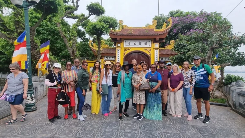 A Metta Voyage group in Hanoi. Photo: Metta Voyage.
How a journey is planned
You tell us the length, the month and who is travelling. We reply with a sample itinerary and a personal quotation. The reference budget on this site, from USD 140 per person per day, is a guide; the quotation is the price. Domestic flights are not included.
Contact
WhatsApp and phone +84 812 247 572; email info@mettavoyage.com. See the contact page.
Photo credits
Photographs are used under the licences below, with credit to their authors. Metta Voyage group photos are the company's own.
- The winding road beneath the peaks of Ma Pi Leng Pass, Ha Giang. Khánh Hmoong, CC BY 2.0. Source on Wikimedia Commons.
- Limestone karsts and a rowing boat at Trang An, Ninh Binh. Jakub Hałun, CC BY 4.0. Source on Wikimedia Commons.
- Hoi An old town across the river. Steffen Schmitz, CC BY-SA 4.0. Source on Wikimedia Commons.
- Mist over the coast from Hai Van Pass. Vyacheslav Argenberg, CC BY 4.0. Source on Wikimedia Commons.
- Cyclists on a quiet mountain road along the Ho Chi Minh Road. Vinnie Cartabiano, CC BY 2.0. Source on Wikimedia Commons.
- Gate of a royal site in Hue. CEphoto, Uwe Aranas, CC BY-SA 3.0. Source on Wikimedia Commons.
- A tourist boat on a Ben Tre canal in the Mekong Delta. Balon Greyjoy, CC0. Source on Wikimedia Commons.
- Palm-lined seafront promenade in Nha Trang. Rayrayokocha, CC BY 4.0. Source on Wikimedia Commons.
- Ban Gioc waterfall in Cao Bang. Adam Jones, CC BY-SA 2.0. Source on Wikimedia Commons.
- Sand dunes at Mui Ne. Vyacheslav Argenberg, CC BY 4.0. Source on Wikimedia Commons.
- Rice terraces in the Pu Luong valley. NKSTTSSHNVN, CC BY-SA 4.0. Source on Wikimedia Commons.
- Limestone peaks of the Dong Van Karst Plateau. NKSTTSSHNVN, CC BY-SA 4.0. Source on Wikimedia Commons.
- A rider on a misty road in Ha Giang. Khánh Hmoong, CC BY 2.0. Source on Wikimedia Commons.
- Karst islets and a boat in Ha Long Bay. Vyacheslav Argenberg, CC BY 4.0. Source on Wikimedia Commons.
- Rice fields and forest near Mai Chau. Shyamal, CC BY-SA 4.0. Source on Wikimedia Commons.
- Morning mist on Ba Be Lake. Rolf Müller, CC BY-SA 3.0. Source on Wikimedia Commons.
- A green UAZ 4x4 jeep with a canvas roof at the Lang Biang viewpoint near Da Lat (not in Ha Giang). Ho Tuan Kiet, CC BY-SA 3.0. Source on Wikimedia Commons.
- Green UAZ 4x4 jeeps parked below the Lang Biang sign near Da Lat, with visitors walking past (not in Ha Giang). The Erica Chang, CC BY 3.0. Source on Wikimedia Commons.
- Motorbikes on the hairpin bends of the Tham Ma pass above a deep valley, Ha Giang. NKSTTSSHNVN, CC BY-SA 4.0. Source on Wikimedia Commons.
- Aerial view of the Ma Pi Leng pass road switchbacking through green hills and terraced fields. Cat Studio, CC BY 3.0. Source on Wikimedia Commons.
- The Ma Pi Leng pass road curving between sharp limestone peaks on the way from Dong Van to Meo Vac. Jaybeelarsay, CC BY-SA 3.0. Source on Wikimedia Commons.
- The turquoise Nho Que river far below the Ma Pi Leng pass at dusk. NKSTTSSHNVN, CC BY-SA 4.0. Source on Wikimedia Commons.
- The Nho Que river canyon seen from above, with sunlight on the water. NKSTTSSHNVN, CC BY-SA 4.0. Source on Wikimedia Commons.
- The town of Meo Vac in its mountain valley under a cloudy sky. HuangWending18072009, CC0. Source on Wikimedia Commons.
- The Lung Cu flag tower on its hilltop above the village. Khoitran1957, CC BY-SA 4.0. Source on Wikimedia Commons.
- The Lung Cu flag tower on its hill, with motorbikes parked in the foreground. trungydang, CC BY 3.0. Source on Wikimedia Commons.
- The Quan Ba valley and its twin cone-shaped hills seen from a viewpoint. Benjamin Smith, CC BY-SA 4.0. Source on Wikimedia Commons.
- A winding track through green terraced hills in the Quan Ba district, Ha Giang. Benjamin Smith, CC BY-SA 4.0. Source on Wikimedia Commons.
- A corner of the old quarter of Dong Van, with traditional yellow-walled tiled-roof buildings. Khoitran1957, CC BY-SA 4.0. Source on Wikimedia Commons.
- The old brick market building in Dong Van, with stallholders in traditional dress outside. Stephan Klage, CC BY-SA 3.0 DE. Source on Wikimedia Commons.
- The main street of Dong Van town between modern houses and green hills. Stephan Klage, CC BY-SA 3.0. Source on Wikimedia Commons.
- The covered food hall of the weekly market in Meo Vac, full of people. Benjamin Smith, CC BY-SA 4.0. Source on Wikimedia Commons.
- A crowded weekly market with tarpaulin stalls in rural Ha Giang. Vuong Tri Binh, CC BY-SA 4.0. Source on Wikimedia Commons.
- A field of white buckwheat flowers below limestone outcrops in the Yen Minh district. Vuong Tri Binh, CC BY-SA 4.0. Source on Wikimedia Commons.
- A field of pink buckwheat flowers on the Suoi Thau plateau with mountains behind, Ha Giang. NKSTTSSHNVN, CC BY-SA 4.0. Source on Wikimedia Commons.
- Terraced rice fields in the valley of Ban Luoc, Hoang Su Phi. NKSTTSSHNVN, CC BY-SA 4.0. Source on Wikimedia Commons.
- Golden rice terraces at Ban Phung, Hoang Su Phi. NKSTTSSHNVN, CC BY-SA 4.0. Source on Wikimedia Commons.
- Water-filled rice terraces in the planting season at De Xu Phinh, Mu Cang Chai. Gió Đông, Public domain. Source on Wikimedia Commons.
- Sunbeams over terraced rice fields in the hills near Sapa. Phi Phi Hoang, CC BY 2.0. Source on Wikimedia Commons.
- Stalagmites lit inside Nguom Ngao cave, Cao Bang. Bùi Thụy Đào Nguyên, CC BY-SA 4.0. Source on Wikimedia Commons.
- A lit footpath winding through the chambers of Nguom Ngao cave, Cao Bang. Adam Jones, CC BY-SA 2.0. Source on Wikimedia Commons.
- Young rice in flooded paddies below karst hills near Nguom Ngao, Cao Bang. Adam Jones, CC BY-SA 2.0. Source on Wikimedia Commons.
- Ba Be Lake with forested hills and low cloud. Ekrem Canli, CC BY-SA 3.0. Source on Wikimedia Commons.
- A small tourist boat on Ba Be Lake between steep forested hills. Adam Jones, CC BY-SA 2.0. Source on Wikimedia Commons.
- A traditional wooden stilt house in a Tay village by Ba Be Lake. Ba Be National Park, CC BY-SA 3.0. Source on Wikimedia Commons.
- A hairpin bend on the Hai Van pass road under a clear sky. Steffen Schmitz, CC BY-SA 4.0. Source on Wikimedia Commons.
- A narrow mountain road cut into a grey limestone cliff in Ha Giang, with two walkers. Quangpraha, CC0. Source on Wikimedia Commons.
- Green rice terraces near Thon Tha village in Ha Giang, with hills behind. Velvet, CC BY-SA 4.0. Source on Wikimedia Commons.
- The gatehouse of the Vuong family mansion in Sa Phin, Dong Van district. NKSTTSSHNVN, CC BY-SA 4.0. Source on Wikimedia Commons.
- The Bac Sum pass road climbing a green valley in Ha Giang. Sketyl, CC BY 2.0. Source on Wikimedia Commons.
- A hillside above Lung Vai, Ha Giang, covered in tea bushes with distant mountains. Benjamin Smith, CC BY-SA 4.0. Source on Wikimedia Commons.


